
✦ AI Summary
Table of Content
▲
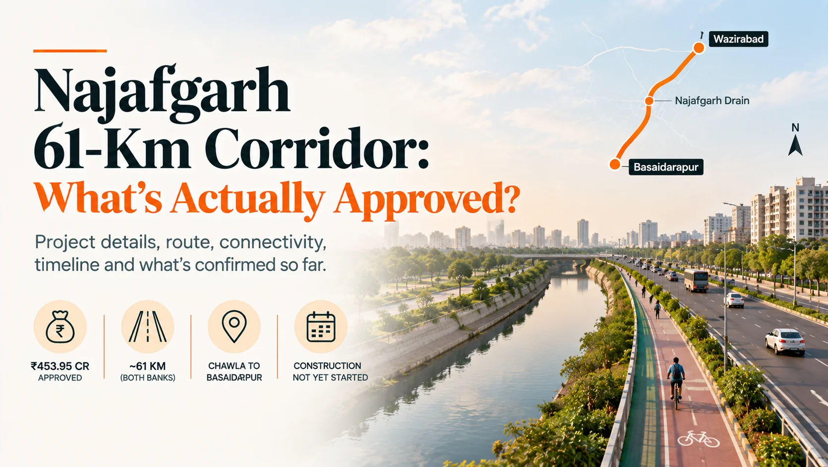
Yes, this project is real and has financial approval. The Delhi government cleared ₹453.95 crore for it in February 2026 but construction has not yet started, and the project is still in the feasibility study and tendering stage as of the most recent reporting. Here's exactly what's been approved, what the 61 km figure actually means, and when this corridor might genuinely be built.
What Does "61 Km" Actually Mean?
The 61 km figure refers to roads developed along both banks of the Najafgarh drain, not one single continuous 61-km road. One detailed report breaks this down precisely: roads will run from Chhawla to Basaidarapur along both sides of the drain, each side measuring roughly 27.415 km, for a combined total of 54.83 km. A separate source puts the "total developed length" at 60.77 km. The headline "61 km" figure appears to be a rounded approximation of this combined, both-banks total rather than the length of any single stretch of road worth knowing before you picture one continuous 61-km highway.
Is It Really Elevated?
The honest answer is: this isn't fully confirmed by the detailed project descriptions available. Despite headlines using "elevated corridor," the actual project detail across multiple sources describes a paved, 7-metre-wide road along the drain, with separate tracks for walking, jogging, and cycling, and mentions of landscaping, boundary walls, and repairs to damaged walls descriptions more consistent with an at-grade service road than a fully elevated flyover structure. The project is also reported to study integration with Delhi Metro rail corridors at a few junctions along its alignment, which is a separate consideration from the road's own elevation. Until a formal, structural project plan is published following the feasibility study, treat "elevated corridor" as the project's working name and branding rather than a confirmed engineering specification.
Route and Connectivity
The corridor is intended to connect Wazirabad to North Delhi, running along the Najafgarh drain and functioning as a high-capacity alternative intra-city route parallel to the Ring Road and UER-II (Urban Extension Road-II). Along its alignment, it's designed to connect with several major existing roads: the Outer Ring Road, Inner Ring Road, Shivaji Marg, Pankha Road, UER-II (which itself connects to NH-9/Rohtak Road), and Najafgarh Road positioning it as a genuine cross-city connector for outer and North Delhi traffic that currently has to route through more congested arterial roads.
The project should be viewed alongside other major connectivity investments shaping Delhi-NCR infrastructure and real estate growth.
Timeline: What Happens Next
The current, officially stated targets are: administrative approvals by March 2026, tendering completed by April 2026, and construction beginning in May 2026. Given this project's history, it's worth applying some realistic caution to these dates. The Najafgarh drain corridor concept was originally proposed around 2012 by the PWD as a much shorter 14-27 km road, and it took roughly 10 years of delay before receiving the financial green light in its current, expanded 61 km form in February 2026. A project with that history is worth tracking for confirmed progress against each stated milestone, rather than assuming the May 2026 construction start will necessarily hold without adjustment.
For outer Delhi and Najafgarh specifically, this corridor, once built, would meaningfully improve connectivity toward North Delhi and reduce dependence on the already-congested Ring Road and Najafgarh Road for cross-city travel, a genuine, long-pending infrastructure gap for this part of the city.





Ans 1. The Delhi government granted financial approval of ₹453.95 crore in February 2026. Construction has not yet started; the project is currently in the feasibility study and tendering stage.
Ans 2. No, it refers to roads developed along both banks of the Najafgarh drain, from Chhawla to Basaidarapur, roughly 27.4 km per side, combining to a total cited between 54.83 km and 60.77 km depending on the source.
Ans 3. This isn't clearly confirmed. Project descriptions consistently describe a paved, 7-metre-wide road with walking and cycling tracks, more consistent with an at-grade service road than a confirmed elevated structure. "Elevated corridor" currently appears to be the project's working name.
Ans 4. It connects Wazirabad to North Delhi along the Najafgarh drain, linking with the Outer Ring Road, Inner Ring Road, Shivaji Marg, Pankha Road, UER-II, and Najafgarh Road.
Ans 5. The current official targets are administrative approvals by March 2026, tendering by April 2026, and construction starting in May 2026 though the project's decade-long delay history warrants some caution about these dates holding exactly as planned.
Ans 6. The corridor was originally proposed around 2012 as a much shorter 14-27 km road and faced roughly 10 years of delay before receiving financial approval in its current, expanded 61 km form in February 2026.
Ans 7. It's intended to provide a high-capacity alternative route parallel to the Ring Road and UER-II, reducing congestion for cross-city travel between outer/North Delhi that currently relies on busier arterial roads.